What is Sensor Data Processing?
Sensor data processing is a systematic method by which raw data collected from various sensors is cleaned, transformed, and analyzed to extract valuable insights. It is a crucial component in managing the complex data ecosystems of smart cities, facilitating decision-making, and improving urban infrastructure.
How Kontur Can Help You with Sensor Data Processing
Kontur utilizes modern technologies to manage the flow of sensor data, overseeing its journey from initial collection to analysis. The platforms we employ are designed to support data sensing and analytics, aiming to provide reliable, prompt, and complete sensor data.
Raw Data Collection
IoT sensors collect environmental data, creating streams of raw environmental data for businesses, tracking key metrics like temperature, pressure, and location.
Data Transmission and Ingestion
The primary system or cloud infrastructure receives this data stream, preparing it for either immediate processing or for storage.
Data Processing and Analysis
The streaming data undergoes real-time analysis using advanced analytics tools. This process enables organizations to gain insights and respond promptly to unfolding events.
Data Storage and Visualization
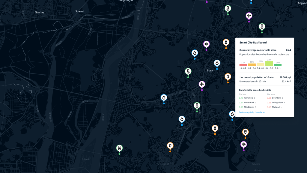
It can then be visualized through our ready-to-use map-based Smart City platform, enhancing the ease of understanding and interaction with the data.
Live Sensor Use Cases for Smart Cities
Live Sensor Data Integration for Smart Cities plays a pivotal role in enhancing the functionality and efficiency of urban areas. Here are expanded topics on the use cases where live sensor data integration can significantly contribute:
Traffic Management and Road Condition Monitoring
Real-time IoT sensor data is invaluable in monitoring traffic flow, detecting congestion, and identifying road surface conditions. Sensors can provide instant road condition reports to relevant authorities for maintenance and to drivers for safer travel routes.
Environmental Quality Assessment
Sensors deployed throughout a city can monitor air and noise pollution levels, providing sensor data analytics necessary for environmental regulation and public health initiatives. This data can be used to enforce pollution control measures and inform city planning to improve overall living conditions.
Public Transportation System Optimization
Live sensor data collection from buses, trains, and stations can lead to improved public transportation systems. Analyzing this data helps in optimizing routes, reducing wait times, and enhancing passenger experience, contributing to a greener and more efficient city.
Energy Consumption and Sustainability
IoT sensors can track energy usage patterns within urban infrastructure, aiding in the development of smarter, energy-efficient policies. Sensor data processing in this context supports the management of resources and promotes sustainable urban living.
Public Safety and Emergency Response
Integrating sensor data from various sources, like surveillance cameras and emergency call data, can help in deploying emergency services more effectively. This integration facilitates quicker response times and better preparedness for handling urban emergencies.
Infrastructure Health Monitoring
Sensors attached to buildings, bridges, and other structures can read sensor data that indicates the health of infrastructure. By analyzing this data, predictive maintenance can be scheduled, and potential failures can be addressed before they occur, ensuring the safety and longevity of city infrastructure.
Smart Utility Management
Data collection sensors within utility systems enable the monitoring and management of water, gas, and electricity distribution. This leads to improved efficiency, leak detection, and better resource management within smart cities.
Case Study: MylesVision Project
In partnership with Donkor Labs, Kontur is working on the MylesVision Project to improve road infrastructure in Africa. This project uses mobile phones as IoT devices along with Kontur’s analytical tools to enhance the reporting of road conditions and safety, aiming to identify necessary improvements and reduce the incidence of road accidents.
Data Collecting
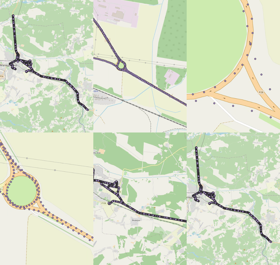
Utilizing mobile sensors, the MylesVision Project collects extensive telemetry data on road conditions across the African continent.
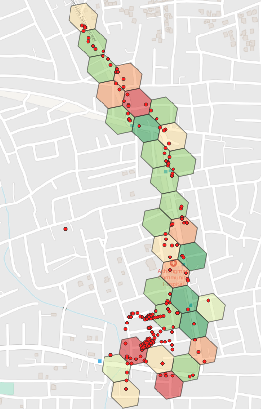
Here you can see how the sensors built into the mobile phone read the bumps on the road.
This data, together with the location, speed and other useful criteria, is collected and transferred to the processing stage.
Data Processing
Kontur’s systems refine this raw data, employing advanced sensor data fusion techniques to ensure precision and reliability.


Data Visualization
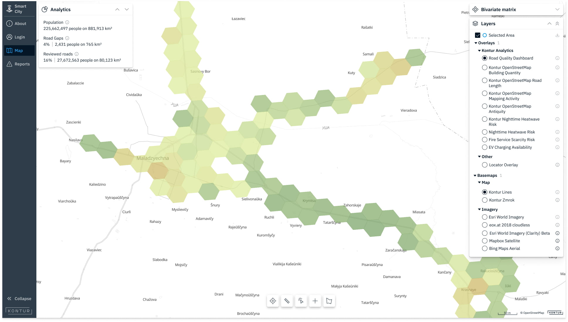
The processed data is then visualized through Smart City platform on map, which allows you to recognize patterns, identify anomalies and create convincing visual descriptions based on your sensor data.

The same principles can be utilized in energy usage optimization, traffic management, waste management, water management, and provide a robust platform for customized urban planning insights.
Custom Live Sensors Data Integration with Kontur
Kontur offers personalized integration services, adapting our sensor data collection and processing capabilities to fit the unique needs of your smart city projects. Whether through our API or native Android client, we provide a tailored solution that brings your sensor data to life.

