 Atlas login
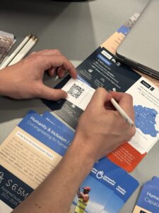

Blog
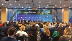
Kontur Presence at the Warsaw Climate Congress
Kontur Team Shines at Franchise Expo Warsaw 2024 with Site Selection Solutions
Kontur at Solar Energy Expo 2024
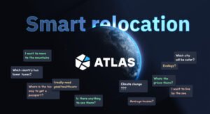
Умный выбор места для релокации
Kontur Team’s Journey in the 30DayMapChallenge 2023
Announcing Population Dataset Release v.5
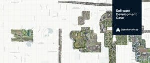
OpenAerialMap — GIS Software Development Case
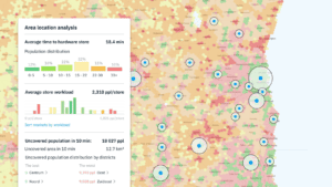
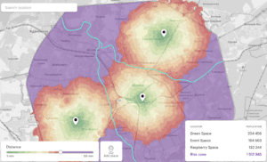
Location Intelligence: The Power of Location Analytics

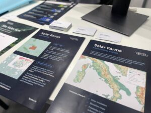
Finding Optimal Spots for Solar Farms with Kontur Platform
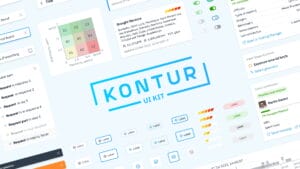
Open-Source UI Kit for Geospatial Applications
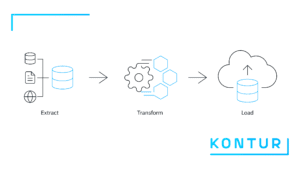
Geocint: Kontur’s data pipeline framework is now open source
Let's stay in touch!
For updates on new products and news.