What is Location Intelligence?
The practice of examining geospatial data to produce insights that can be used to guide decision-making is known as location intelligence. Any information with a spatial or geographic component, like latitude, longitude, and elevation, qualifies as geospatial data. Location intelligence is an effective tool that can give businesses a competitive edge by enhancing their ability to make decisions.
We must first define “location” in order to comprehend location intelligence. With the help of location intelligence, it is possible to identify patterns and trends in customer behavior, market trends, and operational efficiency.
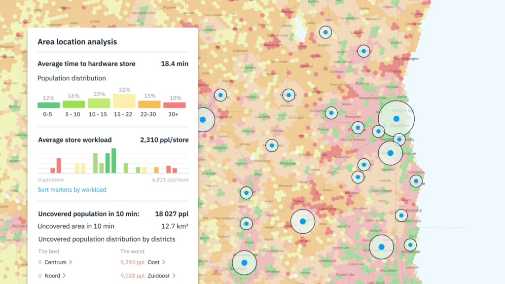
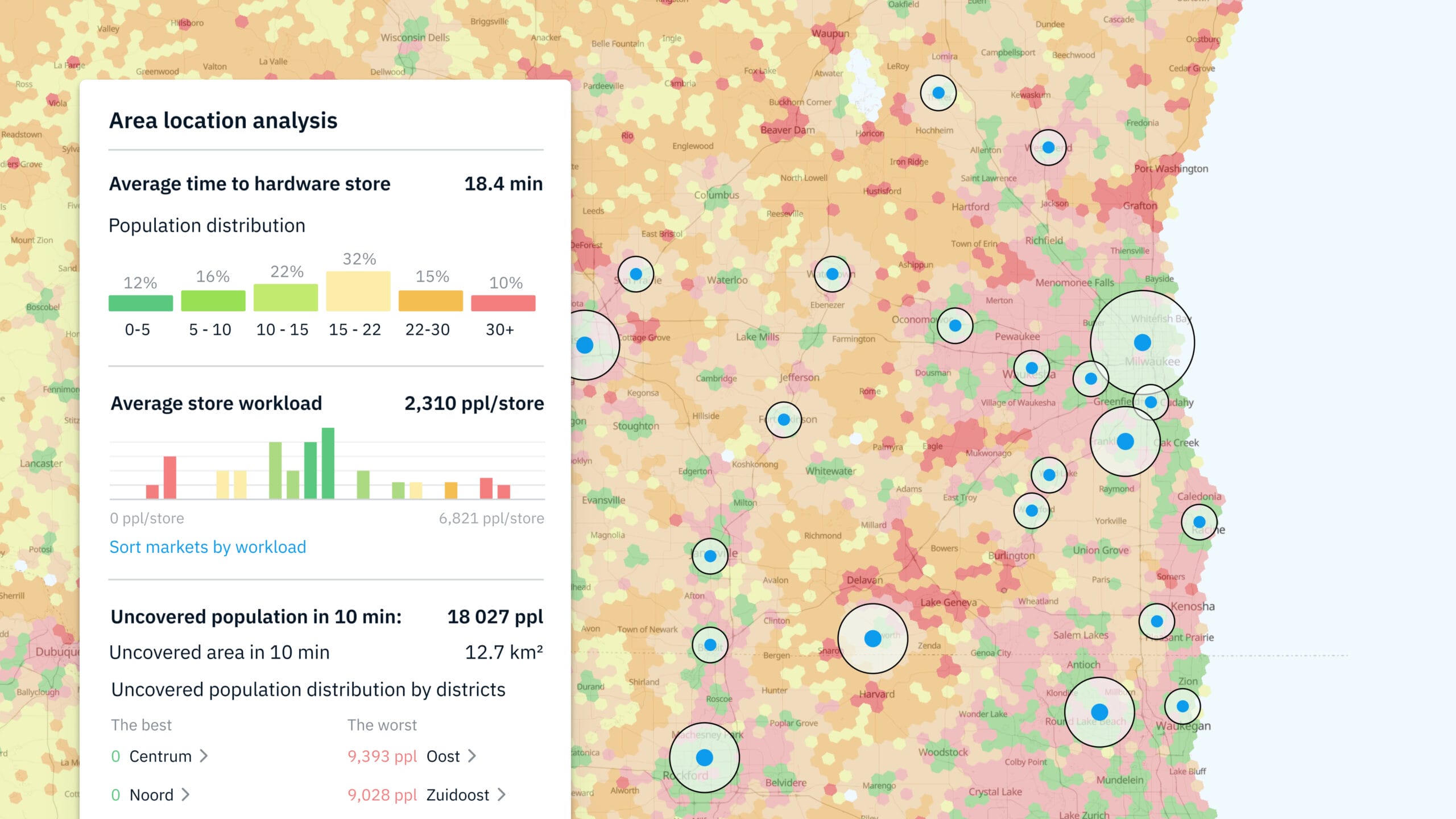
Platforms for location intelligence use cutting-edge analytics tools to display geospatial data in the form of maps, charts, and graphs. With the help of these tools, users can quickly spot trends and patterns in the data, simplifying the understanding of intricate relationships between various variables. Location analytics can also be used to pinpoint high-risk or high-opportunity areas, such as those with high crime rates or regions with a high need for particular goods or services.
Users can examine correlations between various geospatial datasets within a specific area of interest using Geospatial Correlation Explorer, one of Kontur’s Location Intelligence solutions. Users can still perform analysis even if the desired data is not directly accessible because they have the option to substitute data with proxies if the original data is unavailable or too expensive. Additionally, the tool has an intuitive user interface and customizable visualization options that make it simple to spot trends and connections between datasets.
Use Cases
Renewable energy, real estate, insurance, and disaster response are just a few of the industries that can benefit from location analytics solutions. Geographic data analysis can be used to optimize operations, lower risk, and enhance decision-making in each of these industries.
Renewable energy industry
The best places for wind or solar farms can be found using location analytics. Location intelligence platforms can assist energy companies in making informed decisions about where to build their facilities by analyzing geospatial data, such as wind patterns and sun exposure.
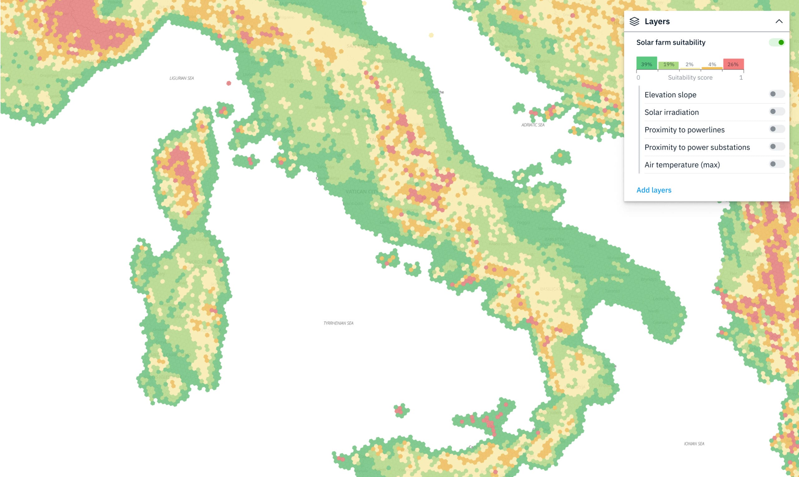
Kontur can offer Site Selection Analysis service.
Real estate industry
Location analysis can be used to pinpoint regions where there is a high demand for specific types of properties, like apartments or office buildings. Rent yields can be maximized and investment decisions can be made using this information.
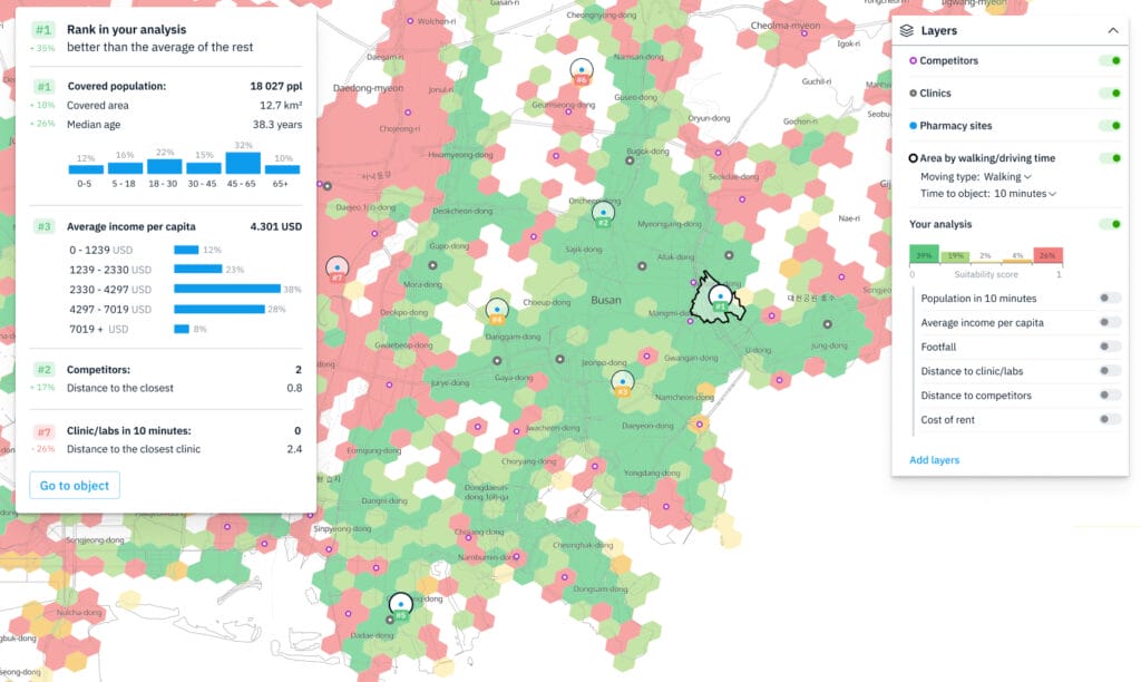
Kontur can offer Site Selection Analysis services, catchment area analysis, and correlation explorer services.
Insurance industry
A high risk for natural disasters like earthquakes or floods can be found using location analytics. In order to reflect the level of risk in a specific area, insurance companies can use this information to modify their premiums or coverage.
Kontur can offer Site Selection Analysis service, disaster feed, datasets with historical disaster data, and correlation explorer.
Disaster response industry
Rapid detection and visualization of areas impacted by natural disasters like hurricanes or wildfires can be accomplished through location analysis. Resource allocation and rescue coordination can be improved with the help of this information.
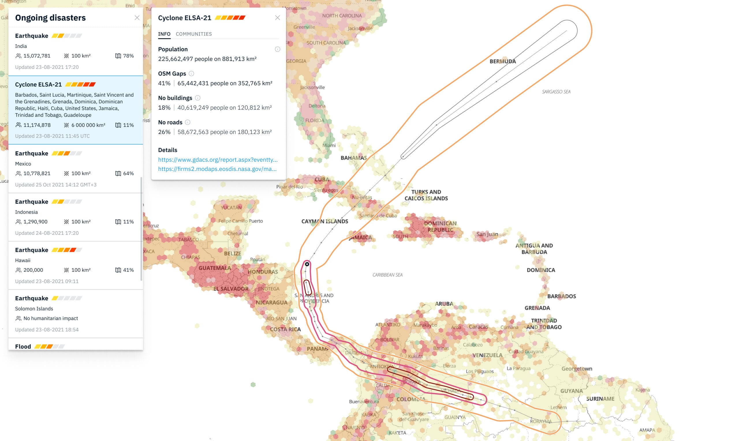
Kontur can offer Site Selection Analysis service, routing, and datasets with historical disaster data.
In summary, location intelligence is a potent tool that can offer crucial insights into intricate connections between various variables. Location intelligence platform makes geospatial data more understandable by using cutting-edge analytics tools to visualize it. Kontur’s platform offers a variety of location intelligence products that can assist governments, businesses, and non-profits in making more informed decisions, lowering risk, and streamlining operations.

