Atlas login
In what ways can we employ data to inform our business decisions?
In today’s fast-paced world, researchers face the challenge of accessing unified, aggregated, and up-to-date data. Research can become time-consuming and inefficient without powerful data processing capabilities and a reliable data source. This is where Kontur Atlas steps in, offering a seamless solution for think tanks to visualize complex data on a map in a highly intuitive and actionable format.
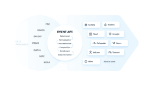
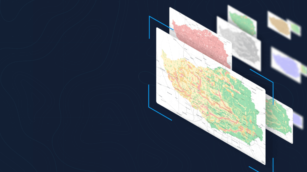
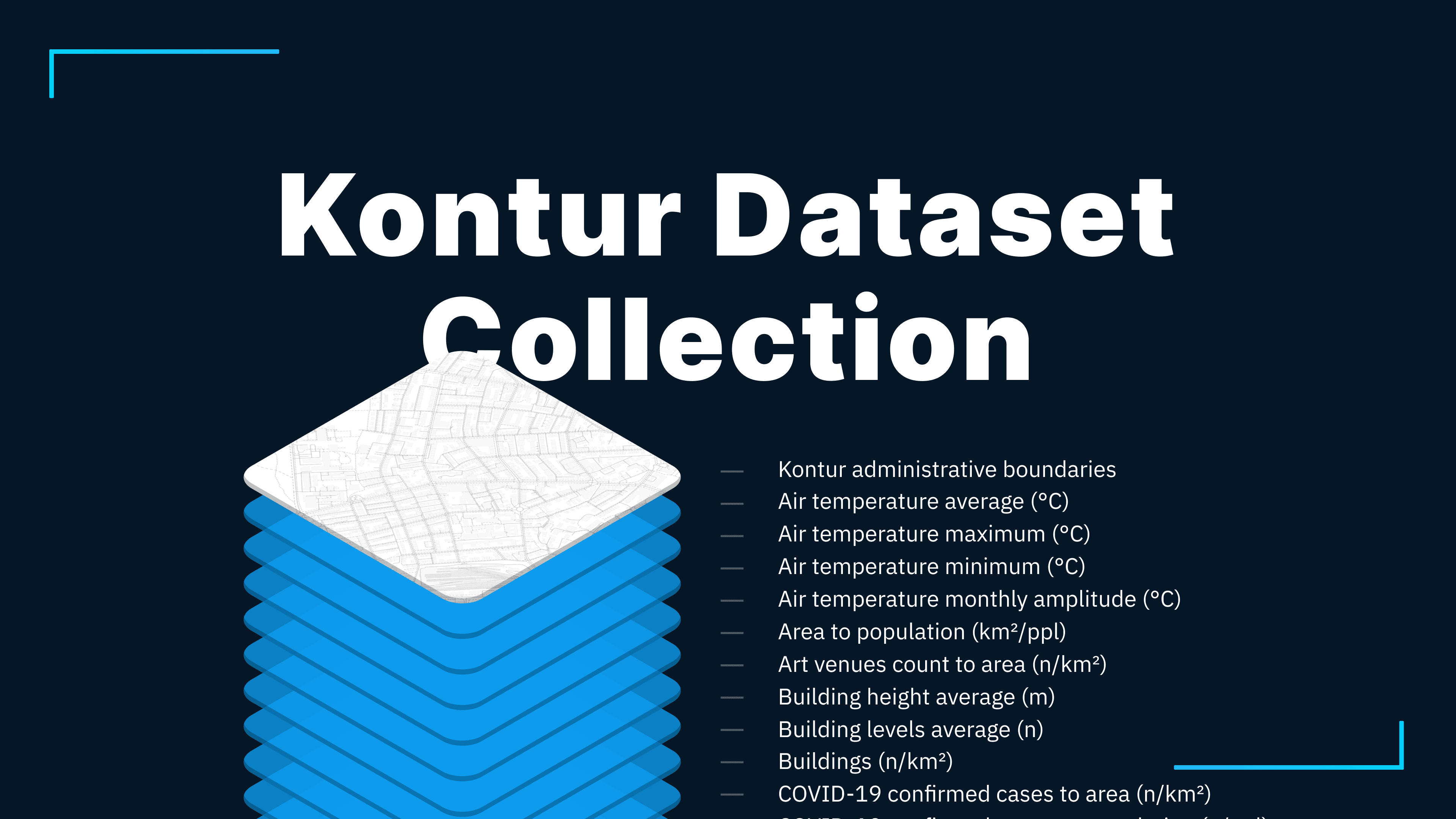
Huge collection of geospatial datasets
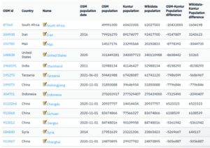
Kontur Atlas provides an extensive range of geospatial datasets, covering socio-economic, environmental, and nature data with global coverage.
Datasets
- cover a lot of topics from socioeconomics to climate change
- spatially aggregated ( Why we use H3? )
- normalized on a unified scale
Our unique transformation algorithms enhance clarity, making it easier for researchers and decision-makers to interpret the data at a glance.
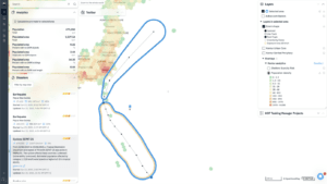
Multi-Criteria Decision Analysis
Multi-Criteria Decision Analysis (MCDA) feature helps assess multiple conflicting criteria simultaneously, such as urban development, economic growth, and environmental sustainability, and identify the optimal solution for any given region or locality.
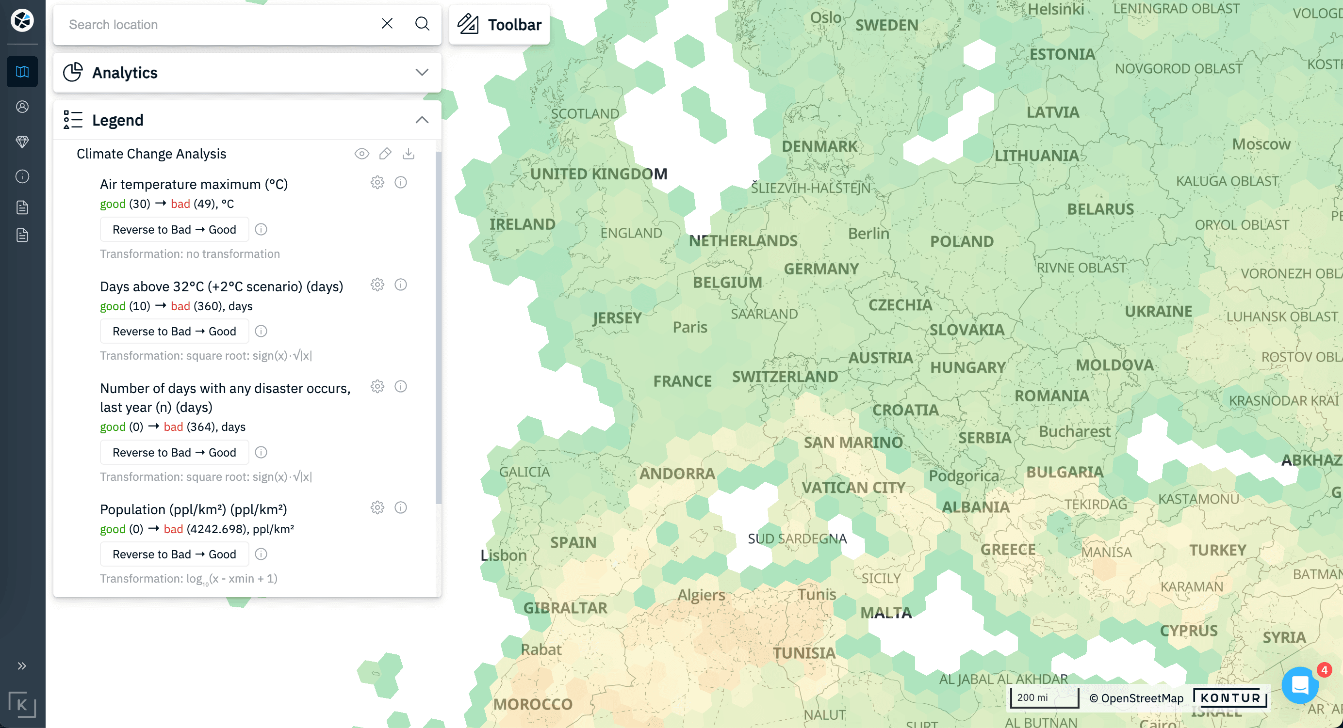
The data is visualized in hexagonal grids, providing a clear, easy-to-understand map, which is especially helpful in avoiding complexity during analysis.
Possible Applications for Research
- Urban and Regional Planning: Analyze land use, housing, and transportation networks to propose smarter, more sustainable cities.
- Environmental Research: Track deforestation, manage water resources, and assess the impacts of climate change on local ecosystems.
- Economic Development: Use population density, income distribution, and business activity data to shape policies that drive growth.
- Disaster Preparedness and Response: Identify vulnerable areas for better planning and resource allocation in times of crisis.
- Sustainable Development: Evaluate long-term impacts on natural and built environments for better resource management.
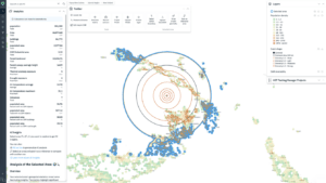
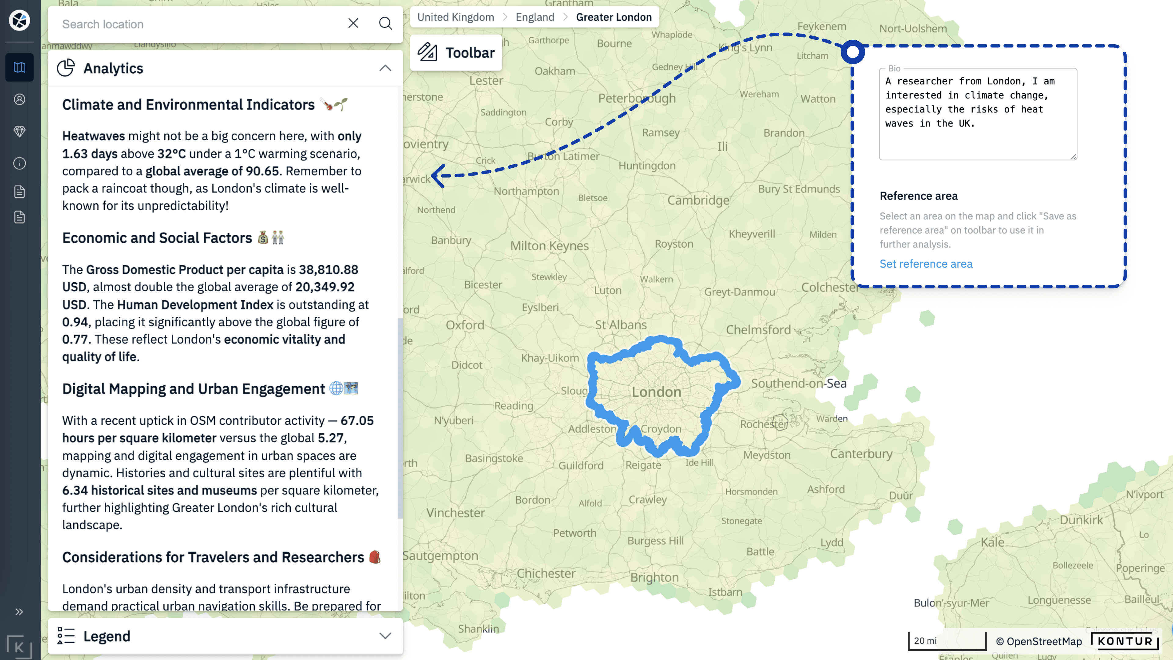
AI Insights for informed decision-making
Kontur Atlas is an AI-powered tool that facilitates data-driven decision-making.
Our AI Insights generates descriptive reports for any territory or administrative unit globally. You can compare regions, analyze specific areas, and tailor the AI analysis to meet your research goals by specifying your objectives in the Bio section. This level of customization ensures that each think tank can derive the insights they need to influence policy and strategy effectively.
Ready to Elevate Your Research?
If you’re focused on strategic research and decision-making, book a demo today to experience the full potential of Kontur Atlas. For those working with regions outside the U.S., let us know what specific datasets would be most beneficial to you.