On January 11, 2025, we’ll celebrate six months since the launch of Atlas — a global map that answers any question beginning with “Where…?”. During this time, Atlas has grown rapidly, enriched with new features and datasets inspired by user feedback. From academic research to saving lives in disaster-prone areas, its impact continues to expand.
What Makes Atlas Unique?
– Access to over 200 statistical data layers: the Kontur Population dataset, as well as datasets on climate change, infrastructure, terrain, economy, urban, demographics, transportation, and more.
– AI-guided multi-criteria analysis (MCDA): Automatically selects the most relevant data layers based on natural language queries.
– Data Transformation: Applies mathematical transformations to optimize data visualization, with manual override options for customization.
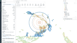
– Hexagonal Granularity: Provides detailed data analysis at the hexagonal level.
– Region Comparison: Enables in-depth comparisons between two regions.
– Data Visualization: representation of geospatial data in a visually interpretable format
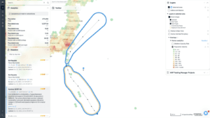
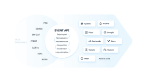
– Possibility to add real-time and custom data on request: Supports real-time disaster data, user-specified datasets on request and notifications.
What’s New in Atlas?
Expanded Data Layers
Atlas now offers 71 new layers spanning various fields, added in response to user requests. For example, our defibrilator layer was created following specific feedback from users. If there’s a dataset you need but can’t find, let us know—chances are we can help.
Guided Multi-Criteria Decision Analysis (MCDA)
Our smart MCDA creation tool simplifies complex decision-making. Just type a query, and Atlas will:
1. Select the most relevant layers
2. Assign optimal settings to each layer.
3. Combine the selected layers to answer your question
Users maintain full control to refine the analysis by adding or adjusting criteria.
Enhanced User Experience
We’ve continuously improved Atlas based on user feedback:
– Navigation and Search: Atlas now allows seamless navigation of administrative units.
– Improved Support: Enhanced customer support and streamlined payment processes ensure a smoother user experience.
Why Choose Atlas?
Kontur Atlas is the best GeoAI implementation I’ve seen.
Kevin Haynes, Professor, University of Texas School of Law.
With Atlas, I can complete tasks much faster and easier.
David Schenkel, GIS Specialist.
The product has 3 tariff plans: Educational, Professional, Custom. The first one allows you to instantly access a wide range of standard data. The latter one allows you to use almost any data you need, including real-time data. This allows a wide range of users to get the necessary data at a fair price.
That’s why Atlas is trusted by professionals across diverse fields:
– Humanitarian Organizations: Vital for disaster monitoring, fire safety optimization, and life-saving operations.
– Site Selection for Business: Evaluating locations taking into account a variety of statistical data to establish a new business, expand operations or relocations.
– Educational Institutions: Used for coursework and research.
– Urban Planners and Researchers: Transforms data into actionable insights for smarter planning.
Every feature in Atlas is built to address real-world needs, shaped by feedback from users like you.
If you are not using our product yet, Book a demo today and see how Atlas can transform your decision-making process.


